The Wrack
The Wrack is the Wells Reserve blog, our collective logbook on the web.
The Wrack is the Wells Reserve blog, our collective logbook on the web.
Hi Everyone,
Thought I would share some numbers from our System Wide Monitoring Program (SWMP) weather station here at the Reserve, and compare them to some values from around the area. First off, it seems we got "lucky" with rain fall totals. Both the Reserve station and the Portland International Jetport weather station reported just over an inch of rain on Tuesday. However rainfall totals varied a bit depending on where those "bands" of precipitation hit… pretty minor event as far as actual rainfall goes, but when that rain is being blown sideways at close to 60mph. Speaking of wind…

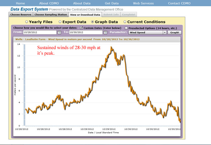
The story here is the fact that we had "sustained" winds of 20-30 mph for almost 8 hours late Monday afternoon into the evening! Our weather station reported a top gust of 58mph at 4pm on Monday afternoon. To compare, top gust at Wells Harbor as reported by the NOAA tide/weather station there was 51mph. Portland Int. Airport reported a top gust of 55mph a few hours after our top gust was recorded. These numbers may not seem "mind blowing" but remember that 74mph+ are considered Hurricane force winds and the fact that we saw 58mph some 300-400 miles north of the center of the storm is pretty amazing! Those sustained winds are what drives the coastal flooding during those high tides.
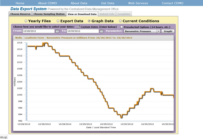
And just for fun, here is a graph showing the barometric pressure crash out as Sandy moved up the northeast seaboard.

Hope everyone weathered the storm okay, and please visit http://cdmo.baruch.sc.edu to check out weather and water data from the Wells Reserve and beyond!