The Wrack
The Wrack is the Wells Reserve blog.
The Wrack is the Wells Reserve blog.
For the second time in less than a year, the Town of Wells and the Wells National Estuarine Research Reserve have teamed up to protect a key parcel of land in the Merriland River watershed.
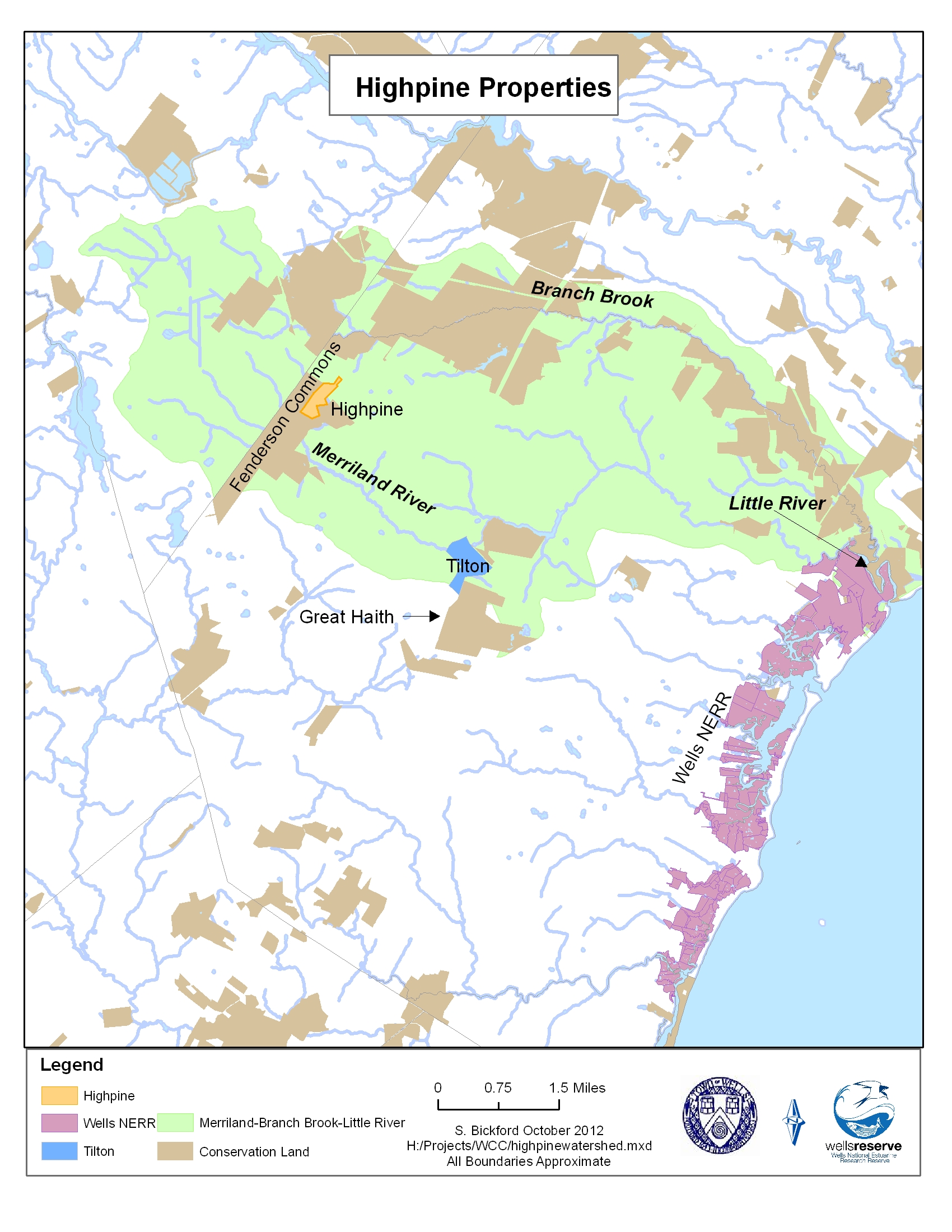
 The 61-acre Highpine Properties parcel consists of forested wetlands, vernal pools, and the headwater streams of the Merriland River. The undeveloped tract has 100 feet of frontage on the Sanford Road (Route 109) and is nestled into the 700-acre Fenderson Wildlife Commons, a designated town conservation area. Protecting the Highpine parcel adds to one of the largest blocks of unfragmented conservation land in southern Maine.
"Protecting land in the Merriland River watershed is a priority for us," said Paul Dest, director of the Wells Reserve. "The Merriland is one of four rivers that flow into our estuaries, so we are delighted to see the river's headwaters protected as part of this landscape-scale conservation effort."
"Two years ago the landowner challenged us to do this without using town funds," said Wells Conservation Commission member Keith Fletcher, who was the project lead for the acquisition. "While the Town of Wells does have a fund for buying land, we were able to meet the challenge thanks to numerous contributors. The property owner also sold the land at well below market value," Fletcher explained.
Fletcher said contributors included the Maine Natural Resources Conservation Program, Wells Reserve at Laudholm, National Oceanic and Atmospheric Administration Coastal and Estuarine Land Conservation Program, Great Works Regional Land Trust, Wells Rotary, and many generous private donors.
"In all we raised over $170,000 in cash and in-kind donations to make this project happen," Fletcher added. "We also received important advice and support from Maine Coast Heritage Trust and The Nature Conservancy."
The parcel was purchased from Highpine Properties LLC, Howard Hall, president, which purchased the land from a developer several years ago specifically to conserve it for the town.
The Highpine project, along with last year's 105-acre Tilton acquisition, will help protect water quality along Wells beaches and in local estuaries. The Merriland River is the major freshwater source for one of three estuaries encompassed by the Wells Reserve and Rachel Carson National Wildlife Refuge. The river originates in western Wells and meanders for six miles before meeting Branch Brook to form the Little River, the largely pristine estuary of the reserve and the refuge.
# # #
Download media release (MS Word)
Download watershed map: Map showing the Merriland River watershed in Wells (green) and conserved land (brown), including the recently protected Highpine (orange) and Tilton (blue) parcels.

