The Wrack
The Wrack is the Wells Reserve blog, our collective logbook on the web.
The Wrack is the Wells Reserve blog, our collective logbook on the web.
The December 23 storm was a real doozy.
Our SWMP stations and NERACOOS ocean observations tell the story in data (scroll down): High sustained winds and very large waves, both aligning with high tide, created a perfect storm. The Wells Reserve experienced sustained winds of 20 to 30 mph for many hours, with gusts up to 46 mph. Water levels rose above mean-high-water and high tide coincided with the storm's peak, when offshore waves were exceeding 25 feet.
In my 22 years with the Wells Reserve, I have been present for every major storm (I suffer from “Captain-of-the-Ship Syndrome" and always want to be here during severe conditions). The inundation coming in from the sea and racing down the rivers on December 23 beats all other storms in my experience.
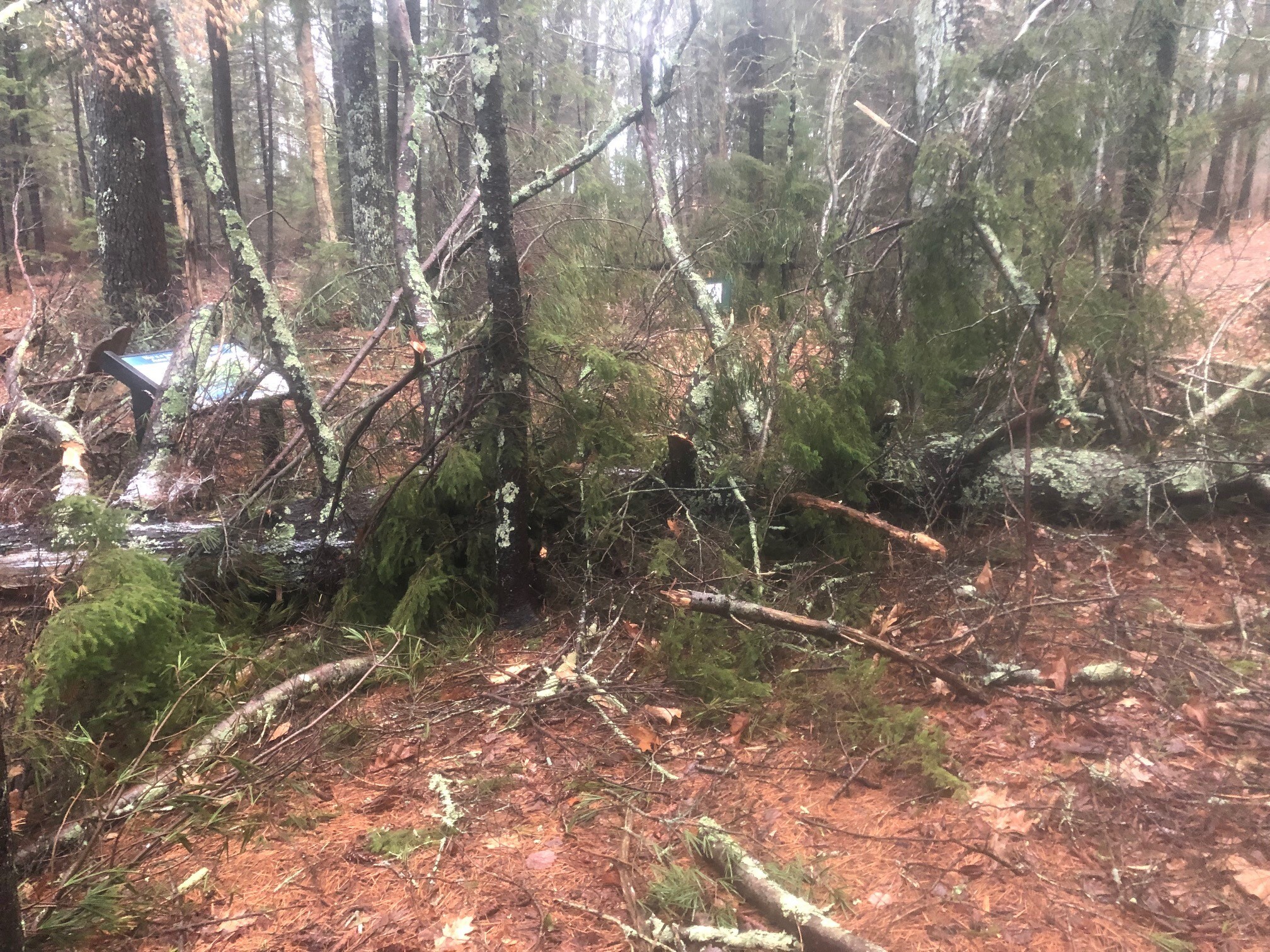
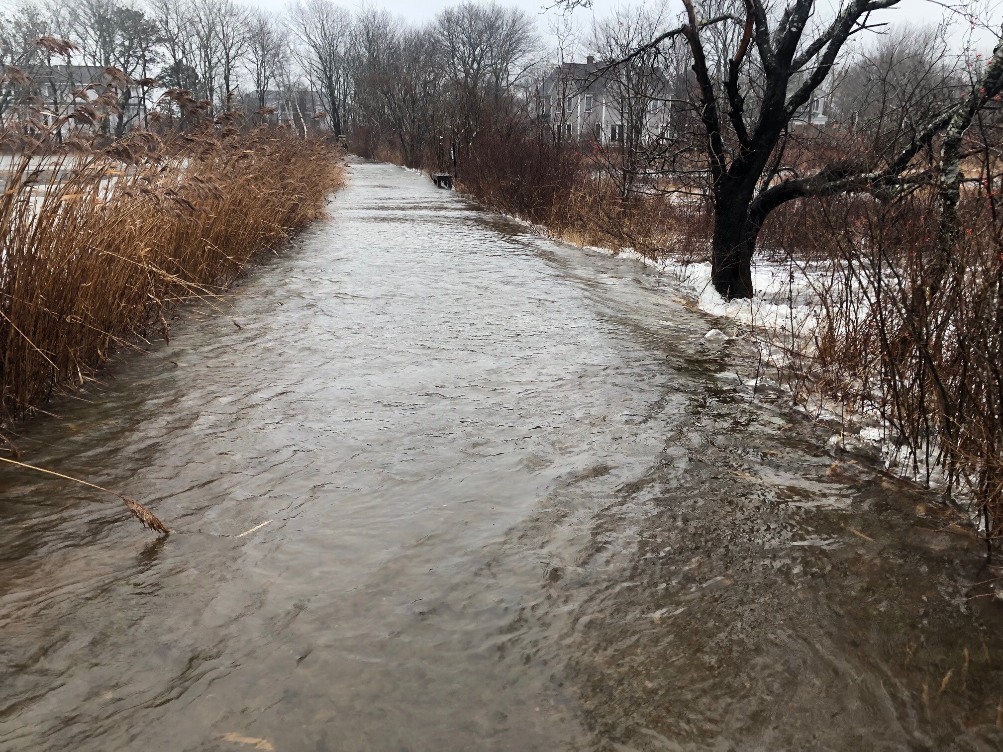
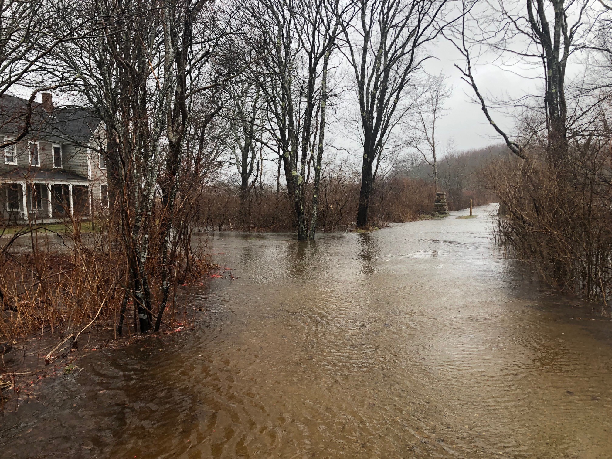
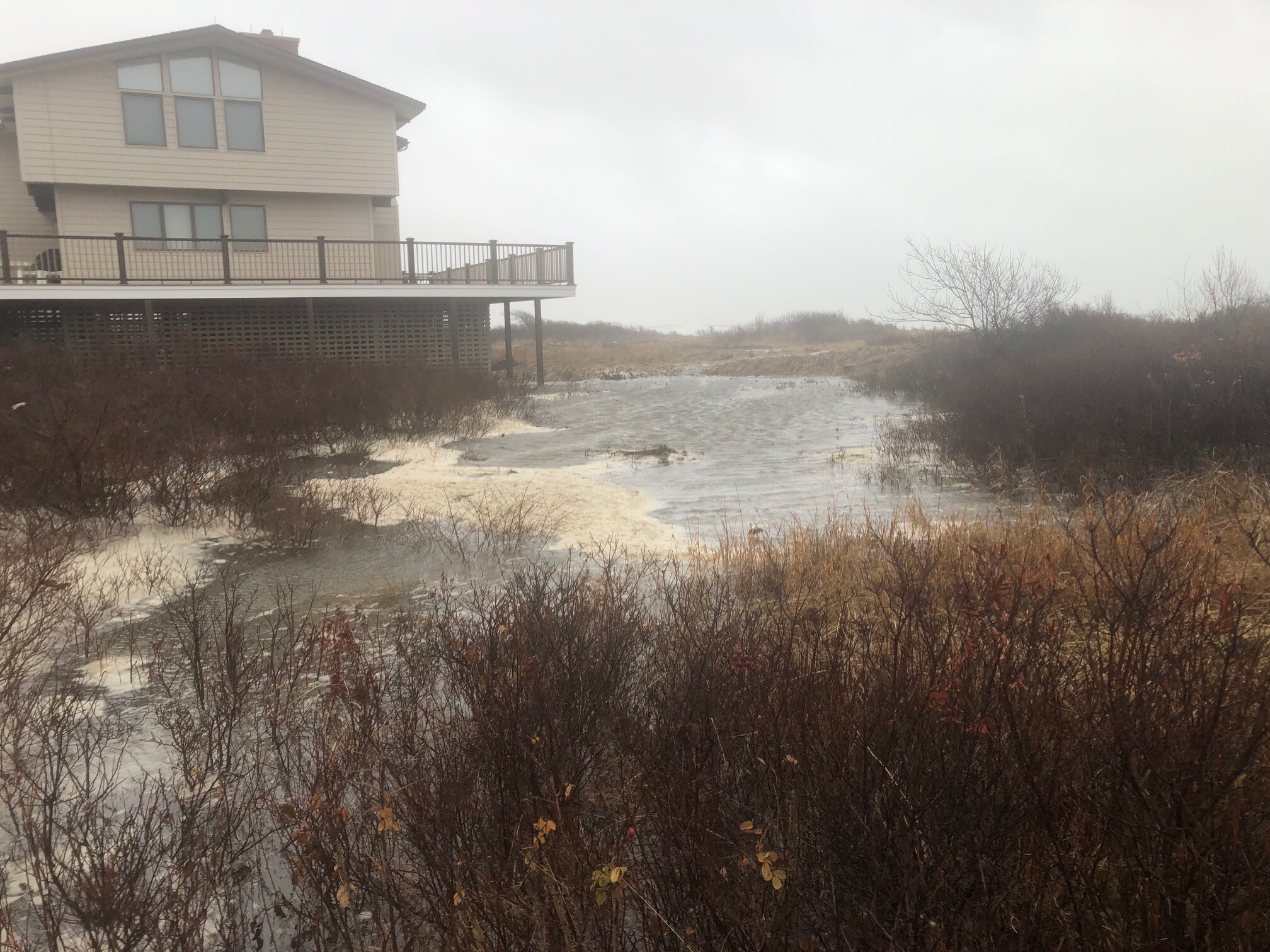
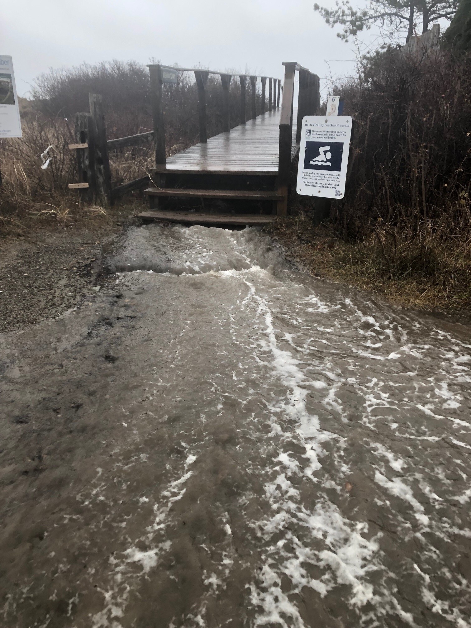
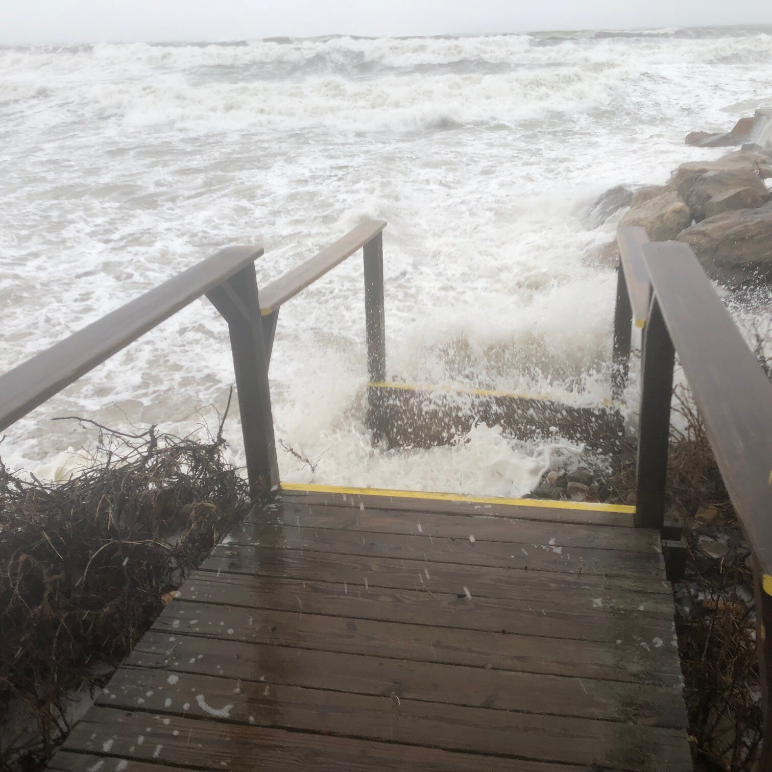
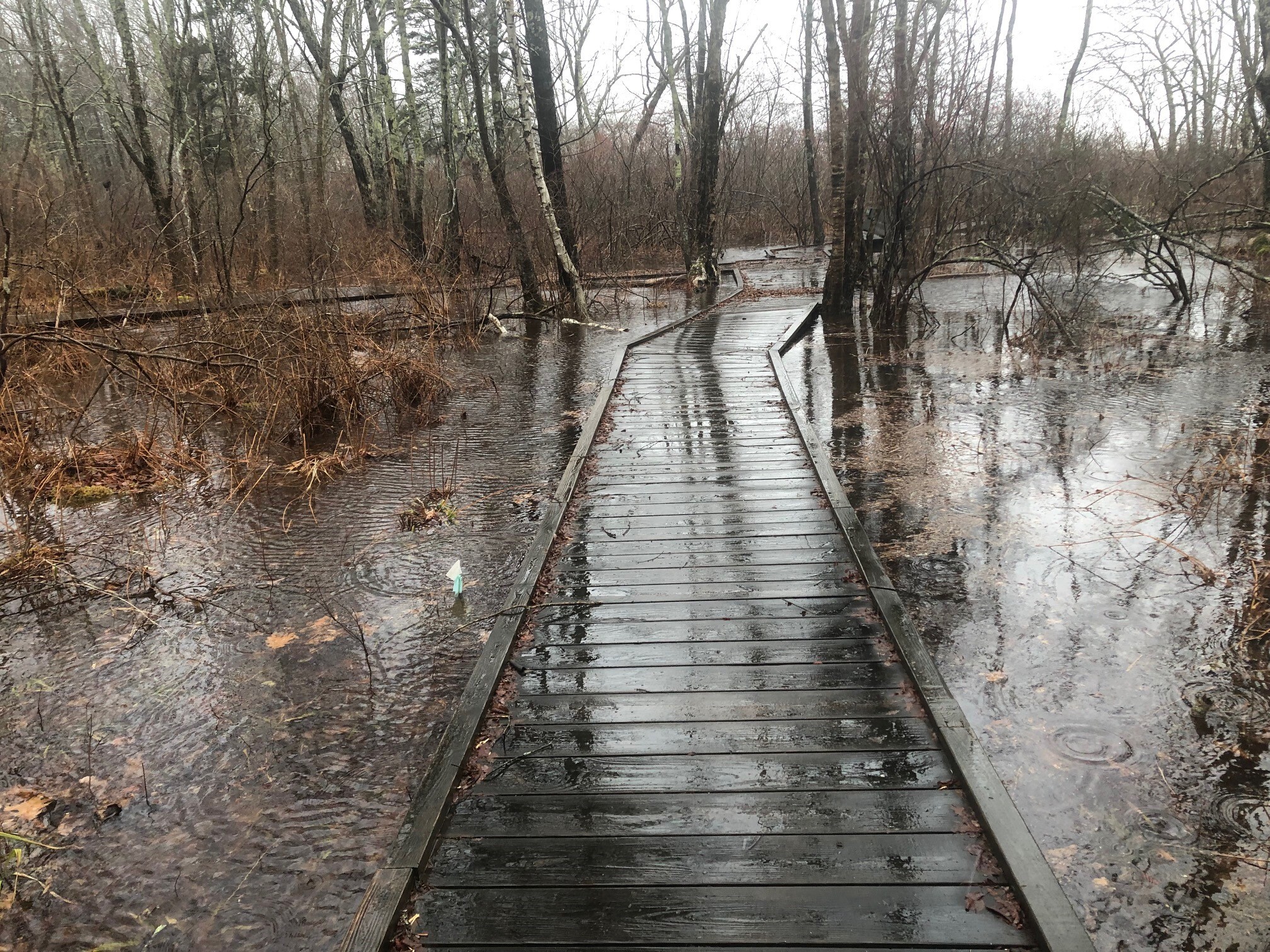
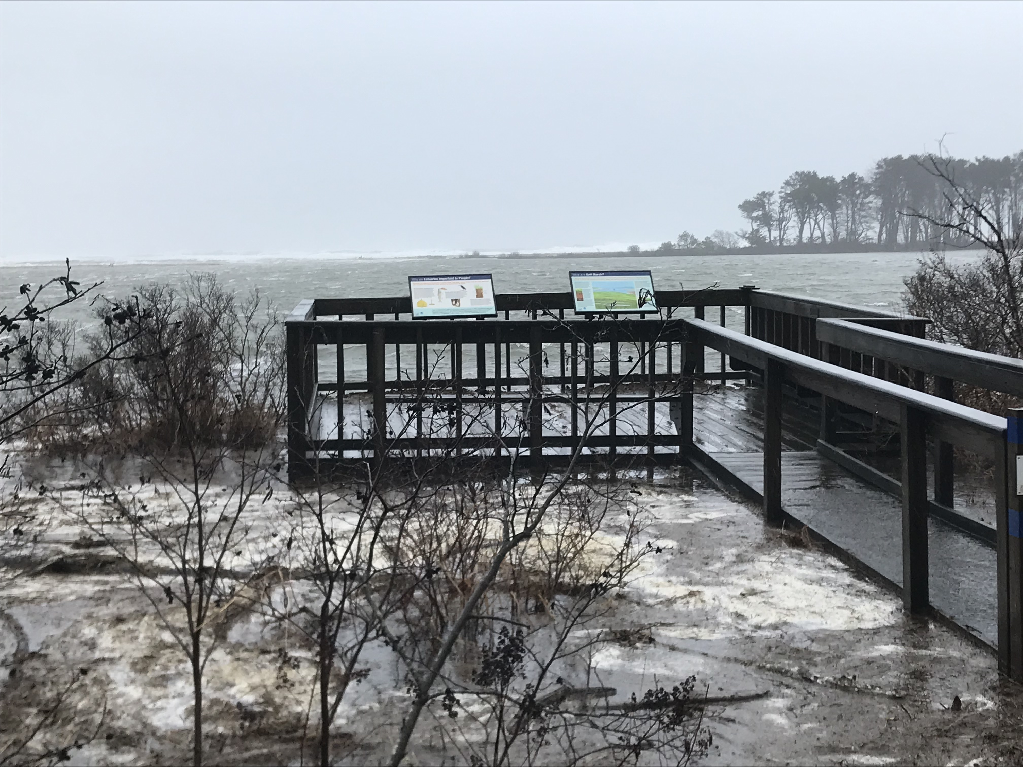
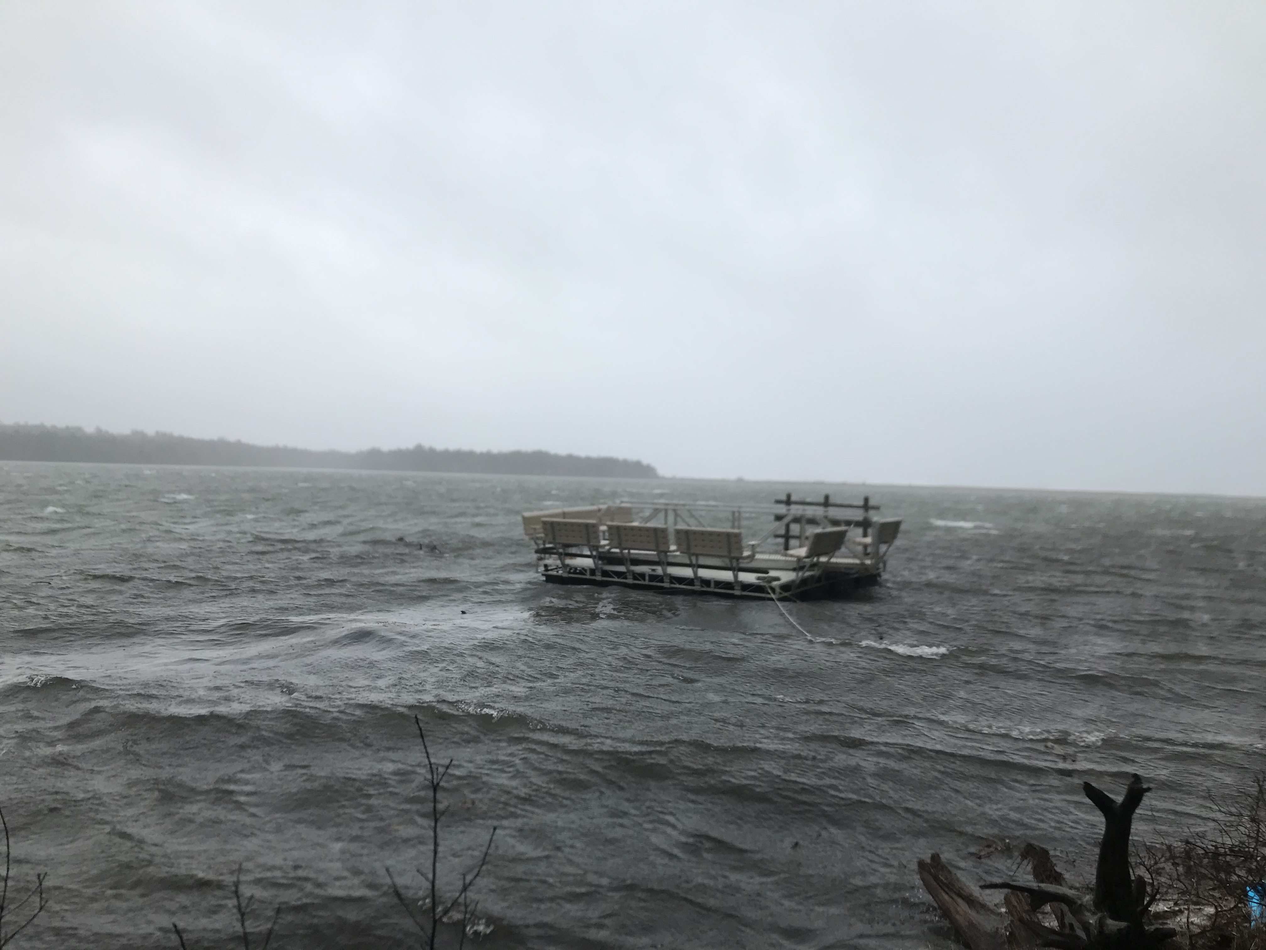
Data is often improved by ground truthing, so, curious about the effects of all the rain, wind, and surging waves (while exercising all precautionary measures), I and a couple of other staff persons donned the best rain and wind gear our research center had to offer and headed toward the shore. Our field expedition in the midst of the storm provided dramatic images of what was occurring.
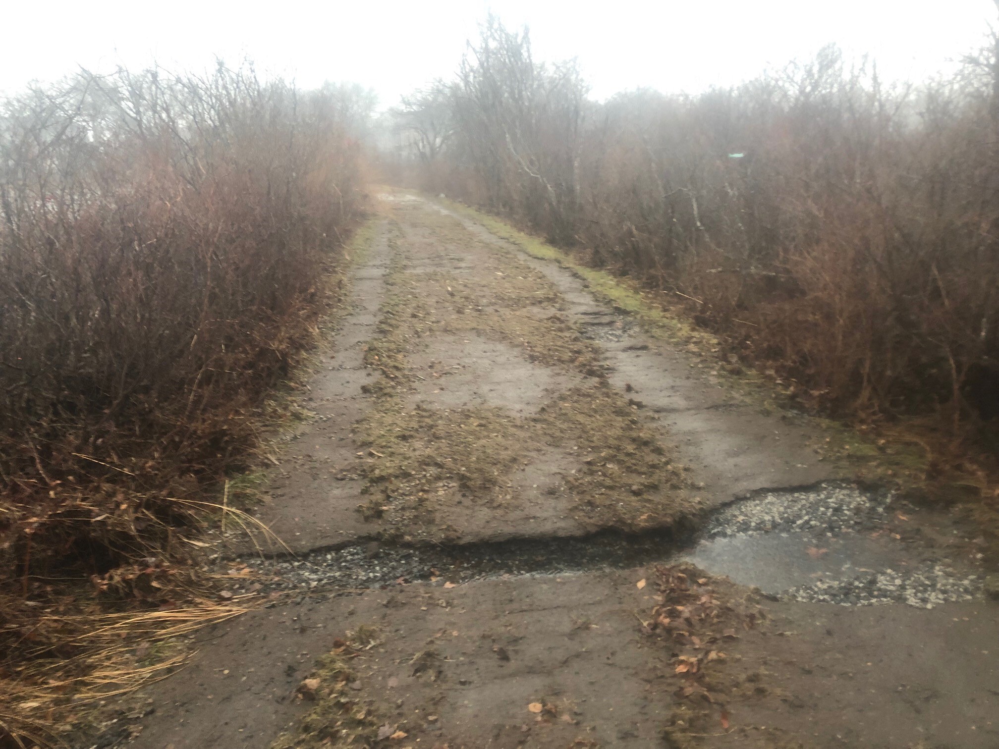
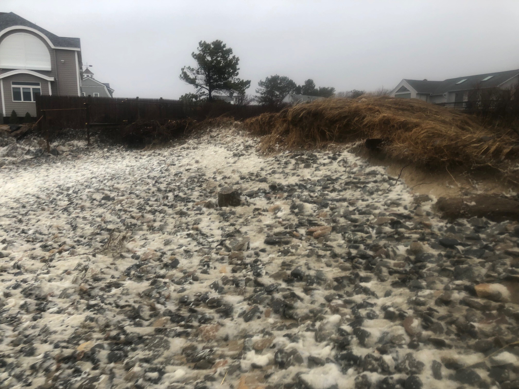
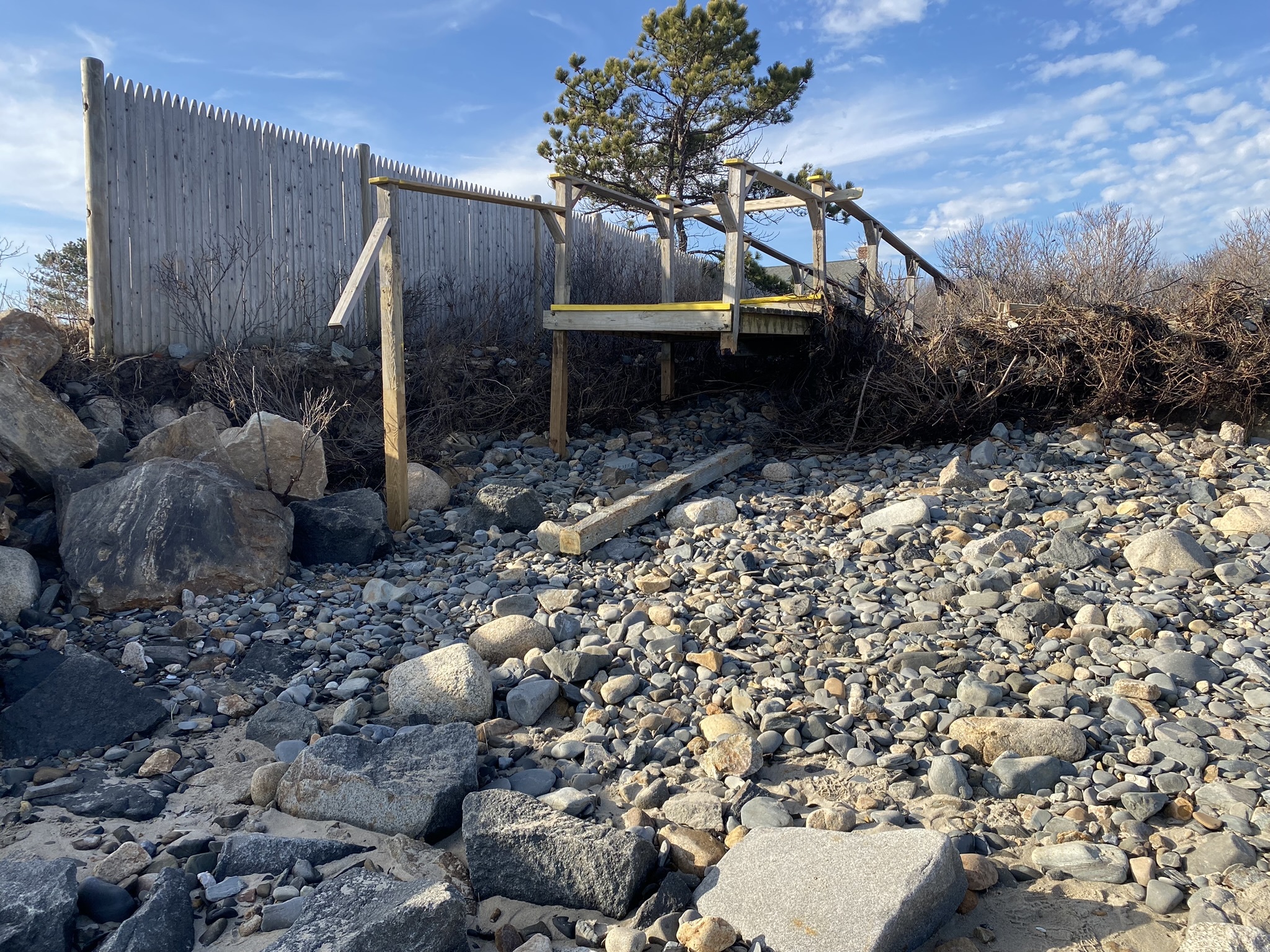
The Barrier Beach Trail dike, which normally separates the Little River marsh from the Webhannet marsh, was totally under water, with a steady stream of water up to 2 feet deep flowing across the trail. On the other side, overwash connected with the flooded Little River marsh, making it appear as one big lake or inland sea. At the beach, the sea was eating away at the dune. In two areas, water breached the dune and was flowing onto the dune grass and into the road. The beach stairs and sections of the boardwalk were gone, taken by the hungry sea, ending up who knows where. I estimate Laudholm Beach lost about 8 feet of dune.
Our SWMP weather and water stations, along with ocean observations, demonstrate the power of the December 23, 2022 event.
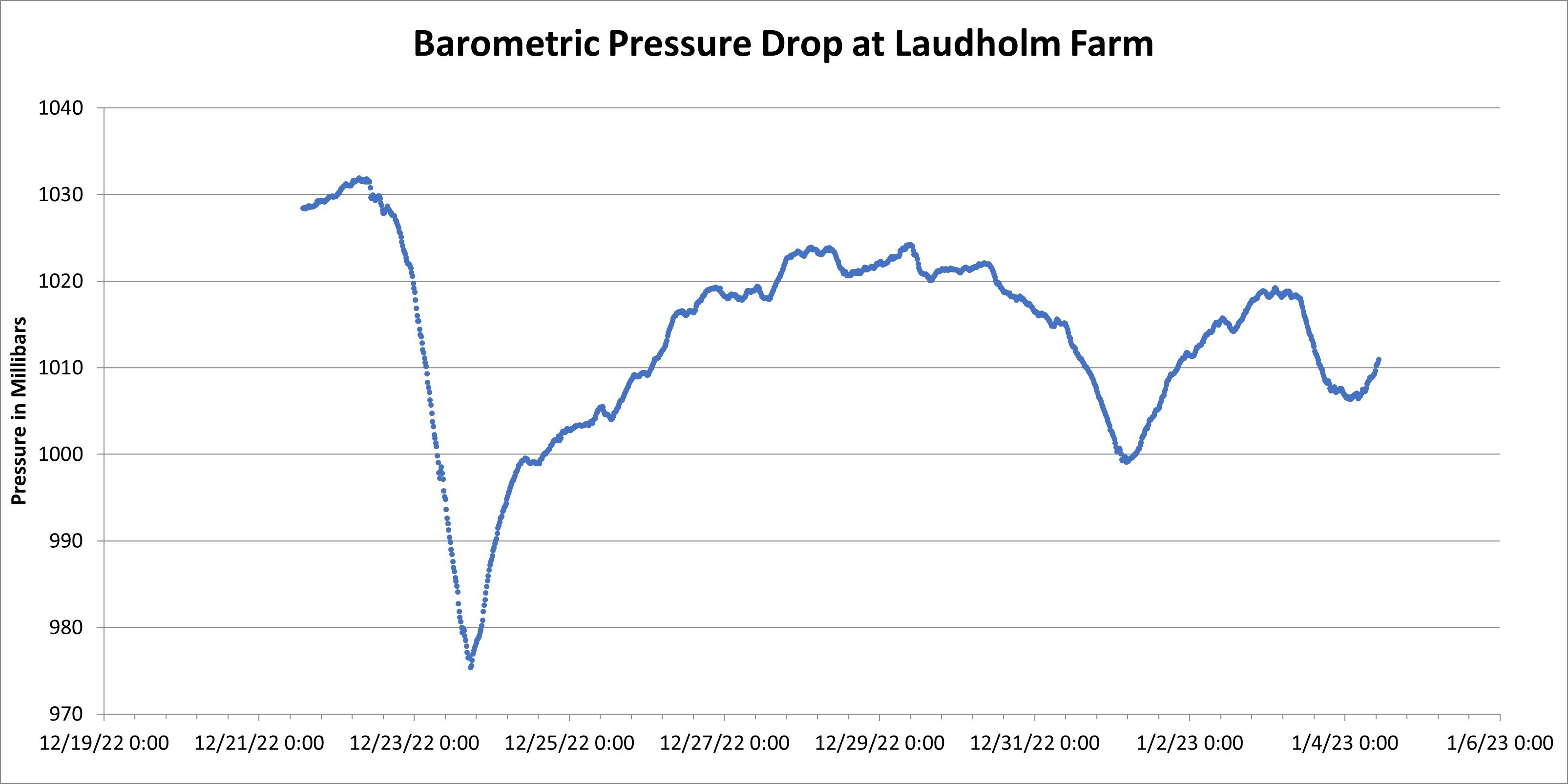
A dramatic drop in atmospheric pressure signaled the big storm's arrival.
The top gust measured at our Laudholm Farm weather station was 46 mph.
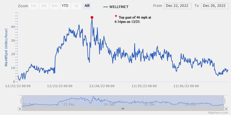
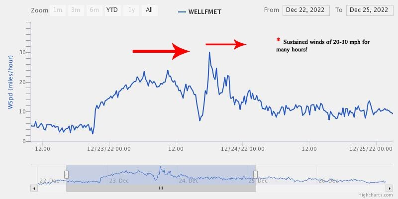
The bigger story was sustained winds at 20 to 30 mph blowing for hours during peak of the storm. We had a brief lull in the afternoon, then got hammered with round 2.
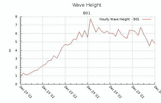
While high tide during this storm was only about a foot higher than predicted, waves were the big story. Coastlines not protected by jetties and harbors saw giant waves coming in during a very high tide. Data below, taken from Western Shelf Buoy B, documented waves regularly surpassing 6 meters—20 feet—during the storm. Massive swells, combined with the high tide and onshore wind, caused extensive damage to Webhannet Drive and Fisherman's Cove here in Wells, Camp Ellis in Saco, and other exposed sites.
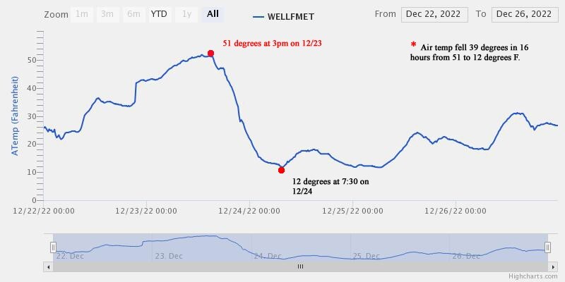
We observed a sharp shift in air temperature as high pressure moved in after the storm. Cold air from Canada swept in quickly, dropping the mercury 40 degrees in 16 hours. We went from a balmy 51°F on Friday afternoon to a bone-chilling 12°F by 7 o'clock Saturday morning. Flash Freeze!
Given the severity of the storm, the Wells Reserve sustained relatively little infrastructure damage. Wind, waves, and rushing water took their toll, but recovery of the human elements in the landscape will be measured in weeks. The dunegrass, sands, and cobbles of Laudholm Beach, on the other hand, merit close attention as winter wears on.