The Wrack
The Wrack is the Wells Reserve blog, our collective logbook on the web.
The Wrack is the Wells Reserve blog, our collective logbook on the web.
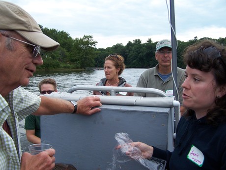
On the heels of the environmental communication course with Eric Eckl at the Great Bay Reserve on August 3rd, the CTP hosted Eric and local environmental leaders and community members for a sunset boat cruise upon our research vessel on the Salmon Falls River.
 I had the chance to go to the annual Low Impact Development Field Trip this past Tuesday to do some research on how to make a difference in my neighborhood. The purpose of the trip was to showcase best management practices around the Acton Wakefield Watershed and Portsmouth, NH.
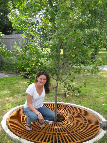
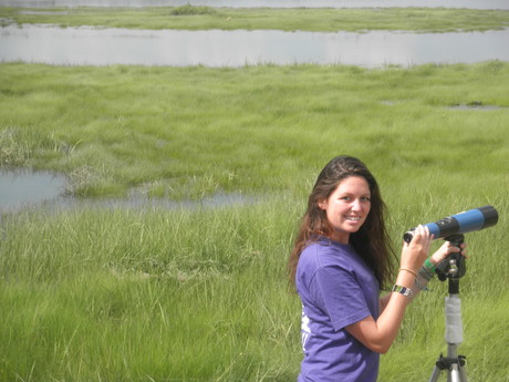 This is my final week in Maine as a research and coastal training program intern for the summer. I have mainly been studying the detrimental effects of nitrogen runoff. The three-year project that I helped start looks at Branch Brook and the Merriland River in the Little River Watershed. We selected 20 sites to analyze nitrogen runoff and how it affects the fish, the macroinvertebrates, the river habitat, and the water quality itself.
I participated in a watershed hike this past Tuesday in the York and Kittery Water Districts. Not only did we see the beauty of the trails around Mount Agamenticus, but concepts about the larger context of the watersheds were discussed. Water district staff and operators attended along with watershed groups, land trusts, and other municipal staff involved with source water protection. After a quick introduciton and history talk on top of Mt. Agamenticus, the group embarked on a 1.5 mile hike through the York and Kittery Watersheds.
To celebrate the summer season, natural resource outreach leaders held a meeting atop Mt. Agamenticus on the first day of summer, June 21st. Mt. Agamenticus covers about 30,000 acres in Southern Maine and proved to be the perfect meeting place to discuss the watersheds of the area. Subjects such as riparian buffers, sustainable development, and water health were discussed in the learning lodge on top of the small mountain. Ideas were shared and traded such as concept mapping. Concept mapping is starting with an idea, such as healthy water, and then branching connected ideas from that main subject. It is a unique activity that shows how others may think. What comes to your mind first when you think of a healthy watershed?
My first day on the job as an intern at the Wells Reserve included a field trip tour of my new home with fellow new interns, Veronica Spolarich and Kathryn Rosengren. Coastal Training mentors Annie Cox and Chris Feurt drove us all across York county to talk about the history of the watersheds in the area.
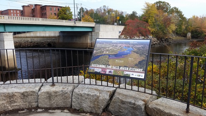
The goal of this project is to protect the Saco River estuary so it will continue to provide services and values to surrounding communities. Investigators are seeking to understand the effects of increasing coastal development on the health of the Saco River estuary and to identify ways to mitigate those effects. The project's full title is "Sustaining Quality of Place in the Saco River Estuary through Community Based Ecosystem Management."
Along the coast of southern Maine, the need to conserve natural buffers to protect rivers and wetlands has become a focal point for tensions between development and conservation interests. In this rapidly developing landscape, decision-makers often feel they must choose development over conservation or restoration to support local economies. While there is scientific evidence that underscores the value of protecting natural buffers around sensitive water bodies, local decision-makers need additional, place-based, economic information about the ecosystem services that these lands provide and the range of tradeoffs that are implied in related land use decisions. A team led by the Wells Reserve addressed this need by working with local, state, and federal stakeholders to better understand, measure, and communicate how southern Mainers value natural buffers and the tradeoffs they are willing to make to protect these critical resources for the future.
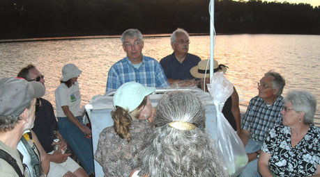 29 people representing 13 towns and organization participated in three boat trips on the Salmon Falls and Piscataqua Rivers in July and August. The trips coincided with the release of the new Land Conservation Plan for Maine's Piscataqua Region Watersheds that covers 18 communities in southern Maine. The narrated tours brought together key municipal officials and conservation leaders to learn about the plan, its goals, and the river's status and history.
Land use changes, particularly the loss of vegetation along the water edges (associated with residential development), are having a significant impact on water quality. The Land Conservation Plan outlines actions that towns and citizens can take to maintain the natural, recreational, and economic resources that this watershed, draining 1058 square miles, provides.