The Wrack
The Wrack is the Wells Reserve blog, our collective logbook on the web.
The Wrack is the Wells Reserve blog, our collective logbook on the web.
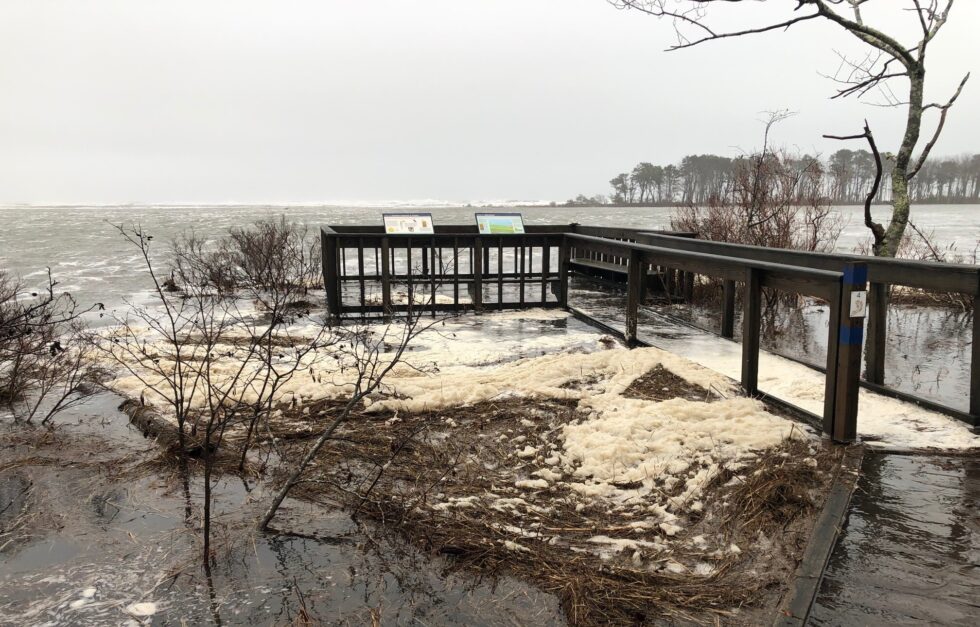
Water levels broke records twice in 4 days, largely due to wind-driven storm surge.
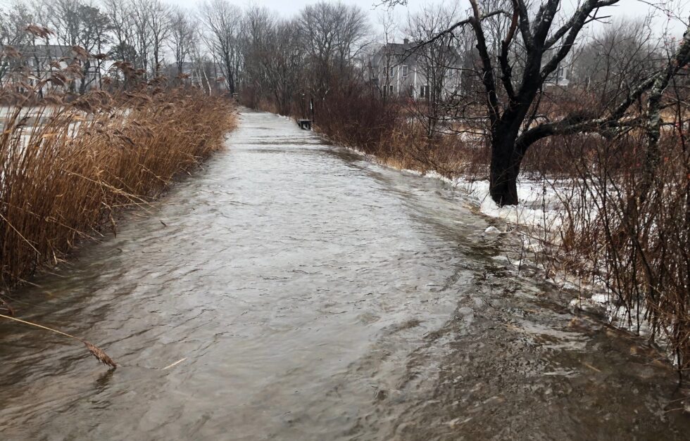
High sustained winds and very large waves, both aligning with high tide, created a perfect storm on December 23, 2022.
It’s too early to tally the full damage from Hurricane Matthew, but I watched closely as four research reserves in our national system took the brunt of the storm.
 Bright and beautiful at the seashore today. People were out. A few of them even talked to Vivien Leigh, reporting from Wells. We know at least a dozen folks took pics and imagine many more will send to the contest.
Email your best one or two before October 15 at 11:59 pm to:
contest@gulfofmaine.kingtides.net
See the winning entries, finalists, and additional images from around the region.
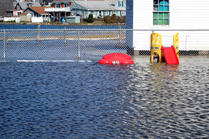
Several of us scattered across estuaries stretching from Ogunquit to Kennebunk, documenting the sea's level and considering the consequences.
We'll start sharing our thoughts with a collection of photos from the day. Up top is Sue Bickford's shot of a submerged crab play set. Below will be…
The following was published in the Biddeford-Saco Journal Tribune Sunday edition, 3/30/2014.
Even though I work for the Wells Reserve at Laudholm, a coastal research and education center, I’d never thought too deeply about flood insurance – that is, until a crack addict knocked on the door of my home one Saturday night this winter.
The following was published in the Biddeford-Saco Journal Tribune Sunday edition, 11/24/13:
Many of the staff of the Wells Reserve at Laudholm were in West Virginia this past week for the annual conference of the 28 national estuarine research reserves. Researchers, educators, conservationists, land managers and even evangelists like me pulled ourselves away from our coastal homes to share ideas, hammer out new projects for 2014, and do some good old-fashioned colleague schmoozing.
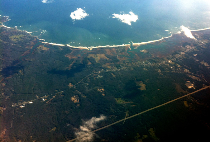
I flew out of Portland on a sparkling, "unlimited visibility" Monday afternoon. My Southwest flight passed three miles above the Wells Reserve, giving me the rare opportunity to get a live bird's eye view of our little corner of the Maine coast. Looking down, I smiled quietly over how beautiful and tranquil the place looked.
May’s flooding washed away two of the Reserve’s water data-logger units used for the System-Wide Monitoring Program (SWMP). Replacing the units was well timed, though, as equipment upgrades now allow public access to “real-time” data on weather and water quality.
About 12 inches of rain fell in parts of southern Maine and seacoast New Hampshire between the 12th and 16th of May, and the sudden flow of fresh water into normally salty estuarine and marine waters will impact fish and shellfish in the region.